

Once upon a time there was a land... Doggerland—a huge area of dry land that once stretched from Scotland to Denmark—was slowly submerged by water between 18,000 BC and 5,500 BC. Today it is a shallow bank and productive fishing ground in the middle of the North Sea.

Contributed by
Glancing at a map of Europe, the North Sea appears to be quite an expanse of featureless open sea separating Scandinavia and the European mainland from the British Isles. The North Sea is, however, not an oceanic abyss but a shallow sea flooding a low-lying part of the continent.
During the last Ice Age when sea levels were much lower, Britain was connected to mainland Europe by a big landmass called Doggerland. Geological surveys have suggested that it stretched from Britain’s east coast to the Netherlands and the western coasts of Germany and Denmark and down the English Channel as far as the Channel Islands.
Research suggests that it was a rich habitat sustaining a human population numbered in the tens of thousands during the Stone Age. It had its maximum extent about 20,000 years ago although part of this area would have been covered with ice. When the ice melted, more land was revealed, but the sea level also rose.
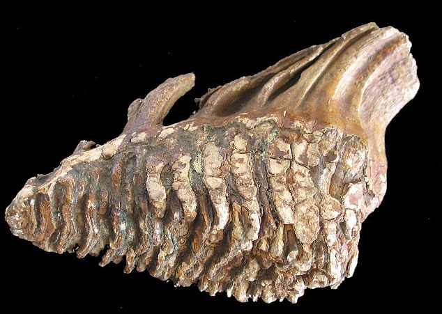
For over 100 years, fishing boats and dredgers have recovered bones, ancient tree stumps, flint used by humans and the fossilized remains of a mammoth and rhinoceros. Interest in the area intensified in the 1930s when commercial trawlers dragged up a number of prehistoric tools and weapons dating to an era when the area was tundra.
But it was only when oil companies started doing extensive surveys and geophysical modeling that researchers were able to re-create what this lost land looked like. Findings suggested a picture of a land with hills and valleys, large swamps and lakes with major rivers dissecting a convoluted coastline. As the sea rose, the hills would have become an isolated archipelago of low islands.
At about 8000 BC, the north-facing coastal area of Doggerland had a coastline of lagoons, saltmarshes, mudflats, and beaches, and inland streams and rivers and marshes, and sometimes lakes. A large freshwater basin occupied the centre of Doggerland, fed by the River Thames from the west and by the Rhine in the east. It may have been the richest hunting, fowling and fishing ground in Europe in the Mesolithic period. From about 6500 BC it gradually became flooded by rising sea levels, reducing the lands to low-lying islands which was probably abandoned for good after being devastated by a catastrophic tsunami.
The wave was generated by a catastrophic subsea landslide off the coast of Norway. The last of the three so-called Storegga landslides happened underwater in the Norwegian Sea, during which an estimated 290km (180mi) length of Norway’s continental shelf collapsed. The slide, which according to carbon dating occurred between 6225-6170 BC, involved the collapse of some 3,500 cubic km of sediment, enough to cover Scotland in a layer 45 meters thick.
Given that the majority of Doggerland was by this time less than 5m in height, it would have experienced widespread flooding. Analysis suggests the tsunami over-ran Doggerland that has since vanished beneath the waves.
Dr Jon Hill from Imperial College London and one of the many researchers who has been analyzing this event told BBC News: “The impact on anyone who was living on Doggerland at the time would have been massive—comparable to the Japanese tsunami of 2011.

The area today
The Dogger bank, as it is called today, is a large sandbank about 260km (160mi) long and up to 97km (60mi) broad located approximately right in the middle of the North Sea. The bank which is now a productive fishing ground extends over approximately 17,600 sq km (6,800 sq mi) with a depth range from 15 to 36 meters (49 to 118 feet) which puts most of this extensive area well within recreational diving range.
Atlantic water enters the North Sea mainly from the north. The topography produces an counter-clockwise circulation. Water entering from the Channel moves eastward along the Belgian and Dutch coast. In the Skagerrak, the North Sea water mixes with less saline water from the Baltic, and is transported north along the Norwegian west coast.
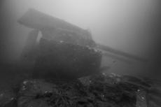
With the North Sea being criss-crossed by some of the busiest shipping routes in the world and having been the stage of several epic navy battles, the area is also home to many good dive-able wrecks whose misfortunes seem to have been strewn generously across the banks.
But it is its natural resources that are its prime asset. The North Sea is one of the world’s most productive areas for fish, and a large number of commercially important species are caught in this area. The German federal agency for nature conservation calls it a “fascinating gem of European marine life” and a world of reefs and sandbanks that “offer a rich home to exceptionally rare and vulnerable species”.

Being located in the middle of the North Sea, Dogger Bank constitutes a bio-geographical divide with cold-adapted benthic (living on or in sea bottoms -- ed.) species to the north and life forms preferring more temperate waters to the south. A 1986 survey, covering the whole of the main North Sea basin, showed clear north-south differences in diversity, abundance, biomass and average individual weight of the soft-bottom fauna. The deeper northern regions had higher diversity, lower biomass, and lower individual weights than the shallow southern regions.
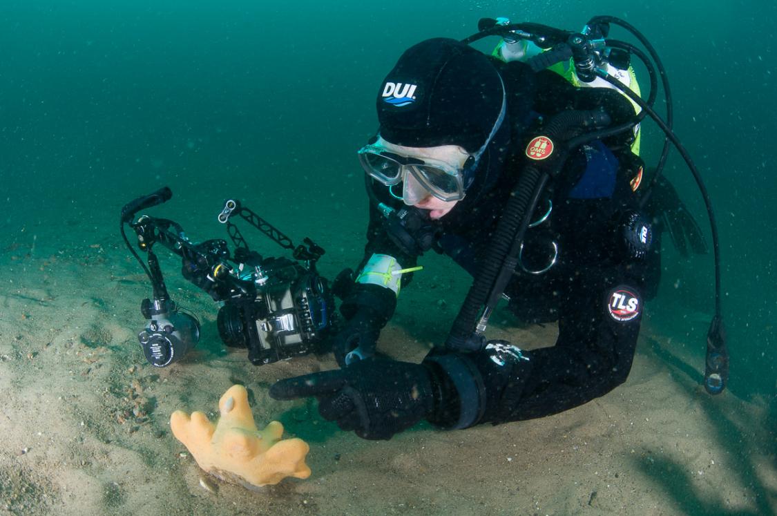
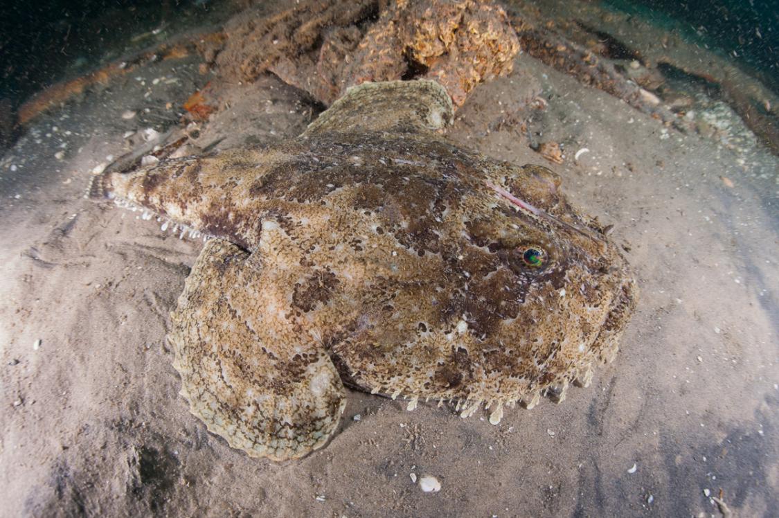
Most of the seabed in the North Sea hosts soft-bottom communities. On the rocky bottom, kelp forests are widespread, and many species of flora and fauna find shelter, food and surfaces for attachment on the kelp and the surrounding rocky substrate. The benthos consists of the organisms living near, on or in the seabed. A wide variety of animals belong to the benthic community: crustaceans, molluscs, annelids, echinoderms and others.
As the North Sea is shallow, there is a strong coupling between benthic and pelagic processes, making the region extremely productive. The diversity of the offshore benthic communities is high, except in areas of direct industrial impact, such as offshore oil fields.
There are also only a few areas of the North Sea that are not fished or left undamaged by trawling. In particular the beam trawl -- which virtually ploughed up the seabed -- can cause damage to substrates and benthic habitats by altering sediment structure and destroying benthic organisms. These structural changes may have long-term negative effects on the structure and productivity of the benthic community.
Diving
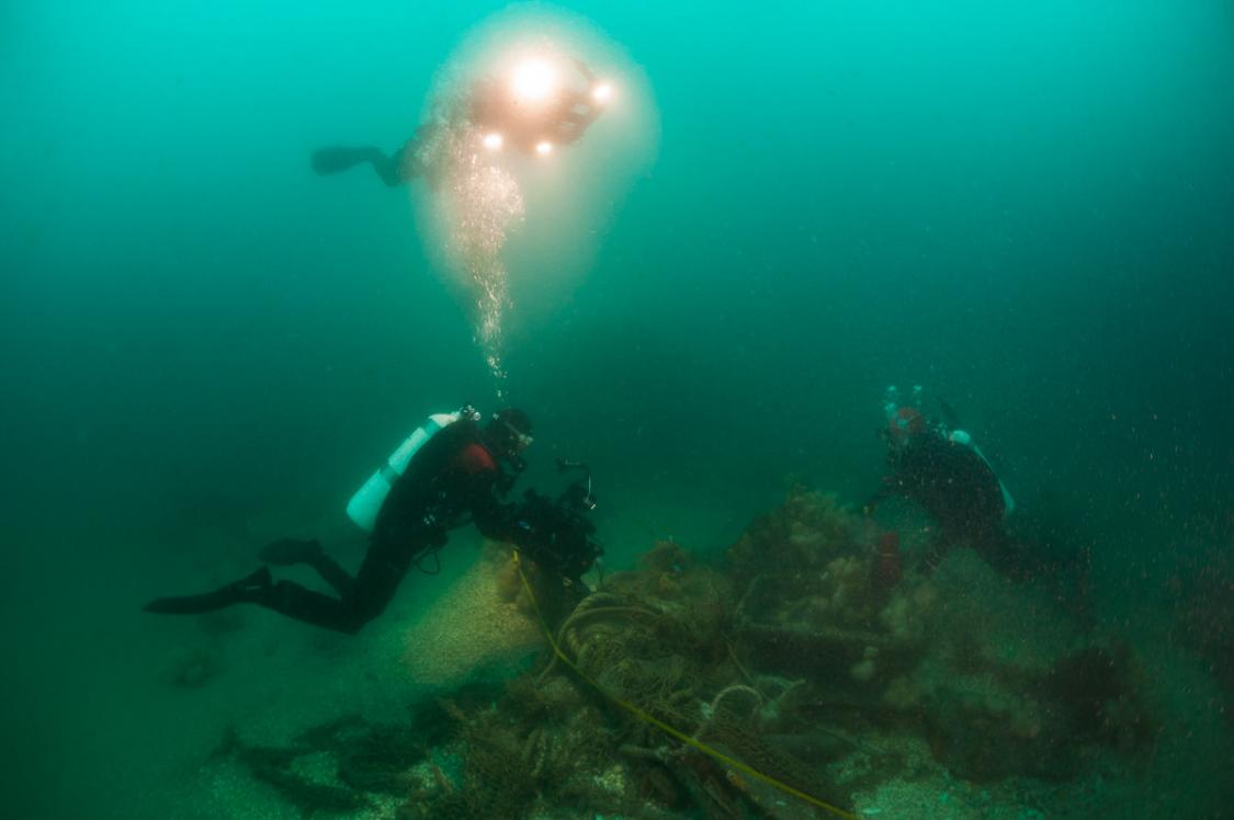
With its location far out to sea, diving on the Dogger Bank requires the support of a larger vessel suitable for the conditions in the open sea, as weather can be unpredictable. Due to its remoteness and the logistical challenges, the area is largely unexplored by divers and with that comes a unique sense of exploration and adventure that is otherwise hard to find in the middle of Europe.
Since 2011 a Dutch team, Duik de Noordzee Schoon (Dive Our North Sea Clean), has been organizing expeditions to the Dogger Bank with the aim of both documenting the nature in these remote areas and to remove lost fishing gear. The removal of the ghost-fishing nets have previously been described by Peter Verhoog in X-RAY MAG #40.


 of the Farne islands")

")
")


")
")


")


